travel gadgets
Gadgets for my trip, from Istanbul to Cairo
On my last trip to Peru (2000), my digital camera was the most "wowed" gadget, this time (2001), it's the GPS.
Features:
- Everyone will ask you, what is this?
- Adventure to places that were impossible to reach before
- Record your whole journey on to computer: good for revisiting or benefiting other travellers.
- Travel longer distant
- ...with shorter time
- Identify current location relative to other known way points
- Know where to get off when taking public bus
- Know the current speed, distant to target, ETA and many more...
What is this?
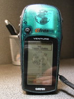
It's a eTrex GPS (Global Positioning System) that use the satellites
to calculate current location. It has a database for most of the
cities in the world. Even small towns like Selcuk, Bergama, Palmyra and Asyut
are included. It doesn't have a map. The higher model (eTrex Legend,
Vista) has mapping functions but is totally useless for the places I
went. To use this unit, you still need a compass, a map
and a good sense of logic.
How to find a location without a map?
First find a known location in your guide book (e.g. a bus station) and
mark it as a waypoint. Then figure out the relative direction and
distant of your target (from writing description of your guide book or locals), you can
then navigate to the unknown destination from the known position.
It is an entertaining mental challenge, but as soon as you
figure out one location, you can calculate the rest.
When it doesn't work?
1, inside buildings.
2, in deep vallleys
3, when climbing (with steep cliffs)
It works best in the desert where I marked the location of the camp and
could navigate from the village to the camp with an unknown path. It
doesn't work well when climbing. First the mountain will block most of
your signals. Then even if you can get a signal, your path is usually
going vertical and overlap with each other. If you follow the treks of your
GPS, you might end up flying off the cliff.
Purchase Price: CDN$210 (tax included)
Pocket size, 12 channels.
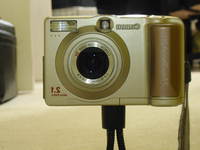
Many people have already got digital cameras this year (2001)
so it didn't cause many WOWs and AHs like last time. But
when I showed this in front of the kids in Malatya, I almost
incite a riot. The sheriff has to interfere.
For more detail description, please refer to my A20 review.
Purchase Price: CDN$ 540 (June 2001)
With 98% deets, the mosquito repellent can eat through plastics. If it's good enough to kill you, it should be good enough to send away the mosquitos. I used it in the Amazon. It seemed to work very well other than the fact that it ruined the LCD of my digital camera (which was stolen later).
Purchase Price: CDN$ 7.50
The dog repellent is weak (0.35% capsicum). It should still has some effects on hostile people (like a weak pepper spray). If not, at least it's good for adding spice to your meals. I saw some wild dogs in Palmyra, but they didn't go near me. Nevertheless, after the Peru Incident, I feel safer with a half baked pepper spray.
Purchase Price: CDN$ 13.00
A mini pocket dictionary I used to store my travel information. Transfering data is a bit clumsy and reading the small screen is not too practical. I guess I need a real Palm pilot for that. But it's small and it's cool. It works well as a dictionary or just to store critical information.
Purchase Price: HK$ 780
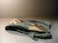
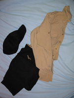
Misty mountain quick dry shirt and pants. It's extremely light and easy to pack. It performs extremely well in desert and hot weather. The pants has 16 pockets. I bought two of them, and I wore them for the whole trip.
Purchase Price: shirt - CDN$32, pants - CDN$39, the hat was CDN$5

